GeoScope blends GPS-stamped photography with live global map views
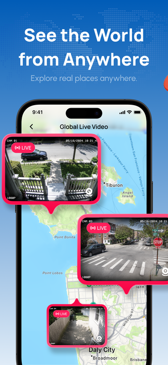
GeoScope: GPS Map Camera, from JOYLINK NETWORK TECH LIMITED, targets travelers and professionals who need verified location photography and virtual place research. The app captures images with embedded geographic metadata while providing public live camera feeds, street-level imagery, a navigable 3D globe, and traffic overlays for situational context. Designed for iPhone users, it pairs practical navigation tools with documentary photo features to support field documentation and remote exploration.
How GeoScope documents location precisely
GeoScope records photos with embedded geographic metadata, storing coordinates, map tags, and precise timestamps to show where and when an image was taken. The camera mode is presented as a purpose-built capture workflow for verified documentation, and the app supports use on iPhone and iPad by requiring iOS 13.0 or later. For professionals who must present location evidence, the recorded metadata is the primary deliverable.
What device and network resources GeoScope uses during live modes
Live camera feeds and the interactive 3D Earth involve continuous data and graphics work, because the app displays public streaming video and renders a globe view with map overlays and traffic layers. Those modes therefore depend on a persistent network connection and active GPU rendering while engaged. Choosing lower-resolution live feeds or disabling the 3D globe when idle reduces continuous data transfer and display updates.
Is GeoScope suitable and safe for verified capture and exploration
GeoScope is built for documentation but requires awareness of embedded metadata; the GPS camera embeds location and time details that support verification, and a built-in compass helps orient captures. User feedback also notes a high frequency of advertisements in the app's open tier, which affects uninterrupted documentation sessions. For users whose workflows demand uninterrupted captures, planning around ad interruptions is advisable.
GeoScope is a practical choice for location-focused users
GeoScope is a practical option for travelers and professionals who need photographic records tied to verified geographic data, with tools that support remote exploration. The trade-off is the app's open tier advertising, which can interrupt active sessions. Recommended.